
Walk a Jeffersontown Street
Begin with a complete address, but expect each record system to answer a different question. The Jefferson County PVA identifies the assessed parcel and owner of record. LOJIC places that parcel on the map and can expose its parent parcel, districts, building traits, and transfer fields. The county deed index documents title. A directory or authorized voter record may offer occupancy evidence, yet neither should be merged with ownership. This five-part Jeffersontown street directory method keeps those roles separate.
- Enter the number and street in the Jefferson County PVA Property Search. Save the parcel ID and the owner exactly as displayed.
- Find the same place in LOJIC Online. Click the parcel, inspect its report, and compare adjacent polygons rather than assuming one address equals one lot.
- Use Kentucky's individual voter lookup only with the required name and birth date. A prepared street list follows a separate SBE-84 request process and purpose rules.
- Search the owner in the Jefferson County Clerk deed index. Track the party role, instrument date, book and page, and any referred-to filing.
- For past occupants, consult regional reverse or criss-cross directories through local libraries and archives. Verify the year and Jeffersontown coverage of each volume.
The result is a chain, not a roster. Label a PVA name as owner, a deed name as grantor or grantee, and a directory name as an occupant listed in that year. That simple habit prevents the most common address-search error.
Save the search date with each result. PVA assessments are tied to an assessment cycle, LOJIC layers carry their own update histories, and deeds have recording dates. If two sources disagree, compare their dates before assuming that one is wrong. A sale may appear in the deed index before an assessment name changes, while a directory may reflect a household from months earlier. For a long Jeffersontown street, work in number order and retain the odd and even sides separately. That makes skipped numbers, corner parcels, and multi-unit sites easier to spot.
Jeffersontown PVA Street Search
The PVA's free address tab accepts more than a full civic address. It can search a street name alone or a number range, and it does not need punctuation, city, state, or ZIP. That makes it the practical first tool for browsing Jeffersontown by street. The parcel tab is also free. Owner, legal, and sales searches require a subscriber account, but the PVA office and Louisville Free Public Library branches provide terminal access to the subscriber service.
| PVA mode | Entry | Access | Street use |
|---|---|---|---|
| Address | Full address, street only, or number range | Free | Build a parcel-by-parcel street list |
| Parcel ID | Full or partial identifier, without spaces or dashes | Free | Resolve similar address results |
| Owner | Subscriber search | Paid or in-person terminal | Find other title records tied to a name |
| Legal and sales | Subscriber tabs | Paid or in-person terminal | Check description and transfer detail |
The result list can export to CSV, and PVA says its site is updated weekly. An assessment record still is not a deed, survey, or occupant list. Its value is the parcel key that carries a Jeffersontown street directory search into the map and land records.
The PVA street-search example for City Hall shows how an address result appears.
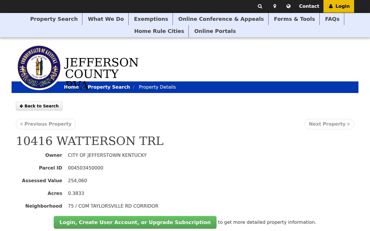
The institutional parcel demonstrates the fields without presenting a private household as a current resident.
Three Jeffersontown Address Meanings
A street directory can show three strings for the same property. The situs address is the physical site mapped by PVA or LOJIC. The owner mailing address receives notices and may be far from Jeffersontown. The legal description identifies land through a subdivision, lot, parcel, parent parcel, or metes-and-bounds description. It remains useful when a road name or number changes.
- Parcel
- A mapped unit of land with a county identifier.
- Situs address
- The physical location assigned to the property.
- Plat
- A recorded map that divides or describes land and lots.
- Criss-cross directory
- A directory arranged by street or address, allowing an address-to-name search.
USPS standardizes mail delivery. LOJIC locates a point or polygon. PVA assesses the parcel, and a deed describes title. Keep those functions distinct, especially with a corner lot, condominium, multi-unit building, or parcel split.
Mailing city and municipal boundary are separate facts too. A USPS result describes delivery, while LOJIC and incorporated-boundary layers describe geography. Jefferson County's addressing rules coordinate the Planning Director, fire districts, LOJIC, and USPS, and an official address is required for building-permit work. That coordination makes the address a useful common key, but it does not turn the mailing label into proof that a parcel lies inside a chosen civic boundary.
Map Jeffersontown Streets in LOJIC
LOJIC Online searches by address, parcel ID, or subdivision. Its map layers include streets, addresses, properties, planning, floodplain, political districts, preservation, transport, utilities, and historic imagery. After a parcel click, the Parcel Report can show the property address, owner mailing fields, assessed year and values, districts, building traits, and repeating transfer rows. Use those fields to check whether an apparent street change is really a parent-child parcel issue or lot split.
The Buffer tool accepts a radius and a unit, then draws from a selected point. A small radius can expose nearby parcel polygons for manual review. It does not define a legal block or neighborhood. Search each parcel report on its own and preserve its parcel ID.
LOJIC's address search returns exact or potential matches and limits results to Metro street addresses. It also normalizes “and” to an ampersand. If a full address fails, try the street spelling shown by PVA, then search the parcel ID. Multi-unit properties may have parent and child parcels, so the first polygon is not always the final one. General Information, Land Development, and Parcel Report views answer different questions. For street-directory work, the parcel report is strongest because it joins title, structure, district, and transfer clues without claiming any person is a current occupant.
Insider tip. A street-only PVA query is fast for the full corridor; LOJIC is better for checking which results are truly adjacent.
Jeffersontown Street Record Layers
No single custodian maintains a public list of everyone living along a Jeffersontown road. Instead, the street directory is assembled from address-linked layers. Each layer has a keeper, a search key, and a defined meaning.
| Record Set | Keeper | What It Shows | Access |
|---|---|---|---|
| Property assessment | Jefferson County PVA | Owner, parcel, value, acres, neighborhood | Free address and parcel search |
| GIS parcel map | LOJIC | Parcel shape, districts, owner mailing and transfer fields | Free map and reports |
| Deeds and liens | Jefferson County Clerk | Grantor, grantee, instrument and references | Online index, archive, Deed Room |
| Voter registration | Kentucky and county election offices | Individual confirmation or regulated prepared data | Name and birth-date lookup; SBE-84 for files |
| Building and public works files | City of Jeffersontown | Applications, plans, inspections and service records held | Specific records request |
| Historical directory | Metro Archives and LFPL | Dated name-address or reverse entries | Archive, print, microfilm, databases |
The parcel ID ties the assessment to the map and helps keep the right lot in view. Owner names and book-page references lead to recorded instruments. An exact address and date range make a city records request useful. When a current title question turns into historical occupancy research, the Jeffersontown city directories explain the regional shelves and year checks in detail.
Access does not end online. The PVA office can answer parcel questions by phone, email, chat, or in person. Deed Room staff can help with document type, release date, and incorrect-information issues. LFPL terminals provide subscriber property access, and Metro Archives supports old directory and Sanborn research. For a city permit or public-works record that lacks an index, the Jeffersontown Clerk/Treasurer is the custodian route. Ask for an existing record rather than a newly compiled street roster.
Jeffersontown Deeds by Address
The recorder index does not begin with a street address. Move from the PVA owner or LOJIC transfer row to the clerk's name search. That form supports grantor-seller, grantee-buyer, or both roles; pure alpha or exact matching; first, middle, and last names; date ranges; instrument types; and index groups. Book-page, control-number, reference-number, refers-to, and instrument-type searches provide other routes once a result supplies a citation.
The current land-record index reaches August 1984. A separate clerk archive covers 1966 through 1984. Earlier books require the Deed Room or archival catalogs. Free viewing and printing are described by the clerk, but image availability can vary. Save party roles and references before moving to the next property.
The Jefferson deed party-name search shows the controls used after an owner is found.
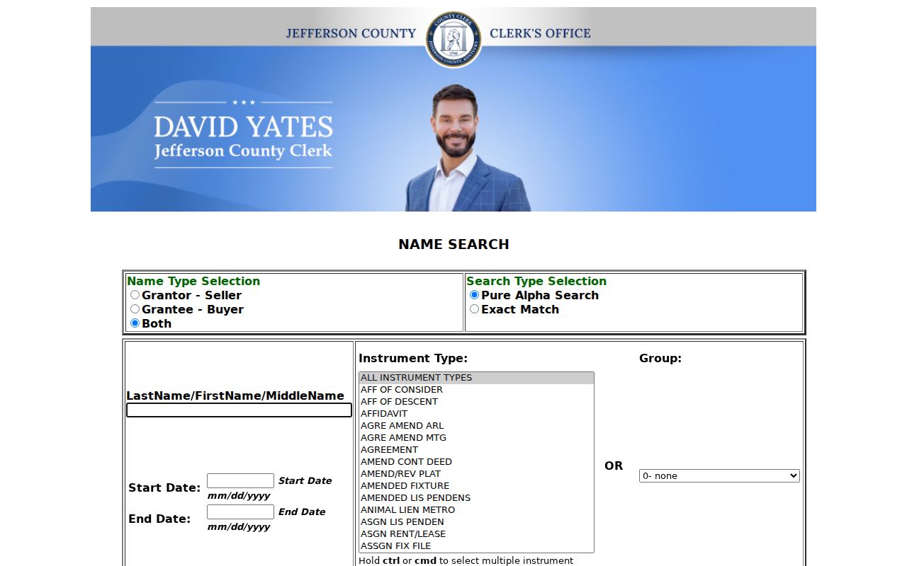
The form confirms why the street address must first be converted into an indexed owner name or recorded reference.
The clerk's online land-record coverage page documents the two digital eras.
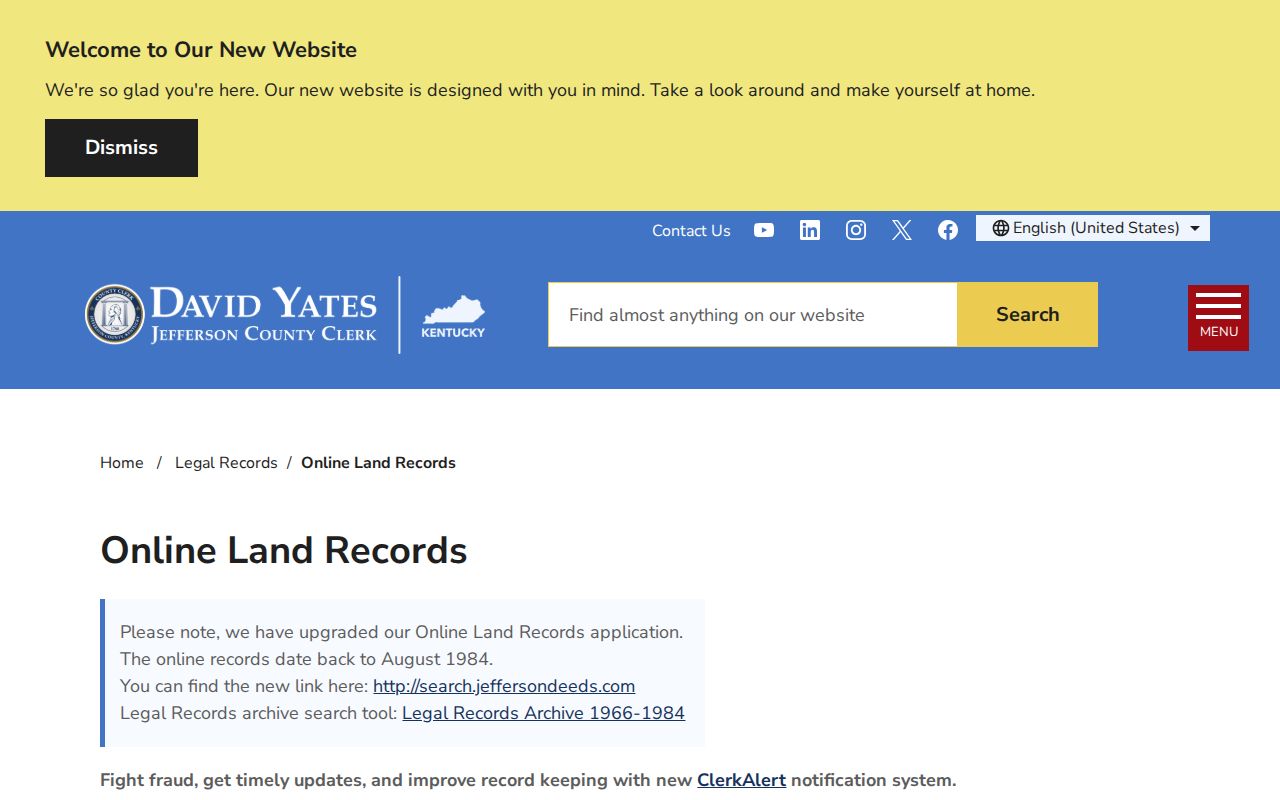
This cutoff is a switch point, not proof that an older deed does not exist.
The name form allows multiple instrument types and index groups, which matters when a parcel passes through an estate, corporation, lien release, subdivision plat, or name change. Search exact match first when the spelling is firm, then pure alpha for variants. A deed is only one instrument type. Mortgages, wills, affidavits of descent, easements, powers of attorney, plats, and releases can all explain a name or boundary transition. Do not treat every recorded party as an owner, and never treat the date of recording as a guaranteed move-in date.
Jeffersontown Permits by Street
Jeffersontown does not publish a permit-search database. The city does publish forms for building, electrical, HVAC, plumbing, fire systems, demolition, signs, pools, accessory structures, zoning, variances, development review, landscaping, and portable storage. Public Works handles driveways, right-of-way work, encroachments, maintenance agreements, and service requests. These files can date work or identify the applicant and owner as recorded at that time.
Request an existing file by exact address or parcel, record type, and date range through the City Clerk/Treasurer. State whether inspection or copies are wanted and in what medium. The city may accept permit applications in person, by mail, or through its permit email, but an application route is not a search portal.
The official Jeffersontown permit page shows the available record categories.
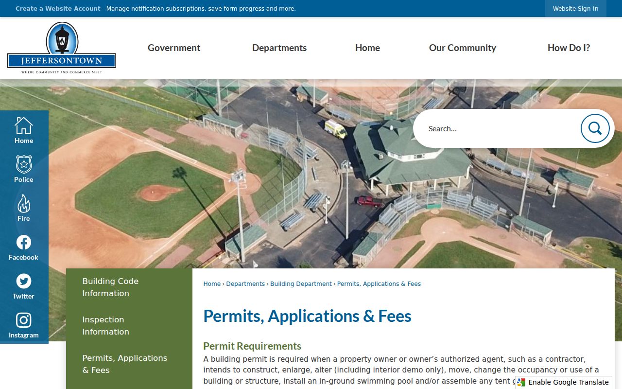
The categories help a requester name the existing street record instead of asking the city to compile a new resident list.
Include the parcel ID when it is known. The request should distinguish a permit application, approved plan, inspection, code case, or public-works service record because each may be held in a different file. Jeffersontown's GovQuest portal routes City Hall and Police requests and can track a request number and key. The city says it will acknowledge, grant, or deny an available request within five business days under its stated process, or explain storage and timing. Copy charges listed by the city are ten cents per page, with separate audio and video media charges.
Jeffersontown Street Names Over Time
Jeffersontown's city history says Main and Market later became Watterson Trail and Taylorsville Road. The Southern Railroad depot and the electric railway that arrived in 1903 changed how older sources described local corridors. Later road widening and the I-64 and Hurstbourne era changed the landscape again. Search both the old and current names when a deed or directory trail stalls.
No official Jeffersontown-wide renumbering date was found. Use the official Street Index File, LOJIC address layers, subdivision plats, and the deed's legal description to bridge a mismatch. County address rules also use quadrants, baseline streets, 100-number blocks, and odd-even conventions. A legal description is often more stable than a street label.
The regional grid places odd numbers on the north side of east-west streets and the east side of north-south streets, with even numbers on the opposite sides. Special rules cover corner lots, angled roads, cemeteries, marinas, and unit entrances. Those rules help interpret a gap, but an old Jeffersontown source may predate the current scheme. Search by subdivision and surname alongside the road. A Sanborn sheet or historic image can then test whether a structure existed under the earlier number.
Note: An old road name is a search variant, not proof that two similar addresses identify the same parcel.
Jeffersontown Voters Are Not Occupants
Kentucky's individual Voter Information Center requires a legal first name, last name, and date of birth, with the last four digits of a Social Security number optional. It has no county field. That makes it a narrow confirmation tool, not a way to browse an unknown Jeffersontown street.
Prepared voter files use the SBE-84 route, a purpose statement, payment, and output choices. State rules describe alphabetical and street formats, but protected and redacted data remain subject to law. More important, a registration entry does not prove current occupancy. Compare its date and role with parcel, directory, or direct confirmation instead of turning it into a household claim.
Common myth. A PVA owner, deed grantee, voter entry, or directory name is evidence of one role, never automatic proof of present residence.
Offline Jeffersontown Street Records
When a portal stops, change channels. The Jefferson County Deed Room at 527 W Jefferson Street, Room 204, answers document-type, release-date, and record questions. The PVA office at 815 W Market Street, Suite 400, and LFPL terminals provide deeper property-search access. Metro Archives holds regional city and suburban directories from 1832 through 2000, except Civil War years, plus historic Sanborn maps from 1905.
The Jeffersontown City Clerk/Treasurer accepts requests for specified city records at 10416 Watterson Trail. KDLA and Kentucky Historical Society catalogs help with older county books. Give staff the street variants, parcel ID, year span, record type, and desired copy or inspection format. That detail is often the difference between a useful answer and a no-record response.
Regional directory coverage reaches from 1832 through 2000, but each volume must be checked for suburban inclusion. LFPL also points researchers to the Louisville Newspaper Obituary Index, Kentucky Digital Library, Sanborn maps, and licensed genealogy databases. The Kentucky History Room is temporarily closed during the Main Library renovation, so remote library help and branch database access matter. For older title books, KDLA's county inventory identifies record series and dates, yet warns that the inventory is not comprehensive. A catalog entry establishes custody, not digitization.
Log Jeffersontown Street Results
A simple research log keeps a long road from turning into a list of unsupported names. Create one row per parcel and record the full situs address, parcel ID, owner label, source URL, access date, and any parent parcel. Add separate columns for owner mailing address, deed reference, directory year, permit file, and map note. Do not overwrite an old value when a later source differs. Keep both entries with their dates and roles.
For the deed portion, note whether a person is grantor, grantee, trustee, heir, or another party. For a directory, preserve the printed street spelling and the year. For voter evidence, document only what lawful access permits and do not publish a compiled household list. A city record should keep its request number and exact record title. These details make the Jeffersontown street directory reproducible and help another researcher distinguish a real conflict from records created at different times.
| Log field | Reason to retain it |
|---|---|
| Parcel ID | Stable link among assessment, map, and title research |
| Role beside each name | Separates owner, recorded party, voter, applicant, and listed occupant |
| Source and access date | Shows which version of a changing public record was used |
| Old and current street forms | Bridges Watterson Trail, Taylorsville Road, and earlier labels |
| Gap note | Marks the next office, archive, or volume to check |
Work from public or institutional examples when demonstrating portal fields. The City Hall parcel is useful because it shows how PVA returns a real Jeffersontown address without presenting a private resident. For personal research, keep the same discipline: cite the field, do not infer an occupant from an owner line, and remove sensitive details from any shared notes.
Limits of Jeffersontown Street Records
A Jeffersontown street directory cannot establish every person inside a home. The PVA and deeds focus on title, so renters and other household members may not appear. Voter data includes only registered voters and follows its own access rules. Directories are dated snapshots. Driver information is protected by federal and Kentucky rules, and utility customer details are not a public resident roll.
Record dates also matter. PVA data changes, deed filings can lag transactions, and a historic directory may omit a household or use a regional label. Confirm a living person's contact details directly when personal safety or fraud prevention is the reason for the search.
Lawful use. Use Jeffersontown address records for lawful personal research. Kentucky law does not permit stalking, harassment, intimidation, or harm.