
Jeffersontown ZIP Directory Coverage
Federal Census profile data associates six ZIP Code Tabulation Areas with Jeffersontown. A ZCTA is a Census approximation built for statistics, not a promise that every delivery point lies inside the city. LOJIC maps USPS ZIP polygons for Jefferson County and notes that some codes form more than one polygon when they cross county lines. USPS remains the source for the mailing code at one exact address.
| ZIP | Area clue | Postal anchor | Boundary note |
|---|---|---|---|
| 40220 | Partly associated with Jeffersontown | Hikes Point is a nearby result | The exact city subset is not published |
| 40222 | Partly associated with Jeffersontown | Lyndon appears in nearby postal results | Postal place and city line may differ |
| 40223 | Eastern Jefferson County area | Verify each address through USPS | The exact city subset is not published |
| 40243 | Partly associated with Jeffersontown | Middletown appears in nearby results | Postal place and city line may differ |
| 40291 | Partly associated with Jeffersontown | Fern Creek is a nearby result | The exact city subset is not published |
| 40299 | City Hall uses this mailing code | Jeffersontown Post Office | Not every delivery point is necessarily in city limits |
This ZIP code directory therefore describes areas that touch or are associated with Jeffersontown. It does not assign every address in a code to the city. No official source located a population total, voter count, or named-neighborhood list for each city subset, so those figures should not be inferred from a broad ZIP total.
Jeffersontown ZIP 40299 Anchor
The strongest postal anchor is 40299. Jeffersontown City Hall uses that ZIP, while the Jeffersontown Post Office listing identifies a station at 3801 Billtown Road, Louisville, KY 40299-9998. The different place names are useful evidence of the core issue: a post-office label organizes mail, while a municipal boundary organizes city government.
The station listing gives weekday hours of 8:30 a.m. to 5:00 p.m. and Saturday hours of 9:00 a.m. to 1:00 p.m. That is an in-person fallback when an address lookup is unclear. A clerk at a postal station can address delivery questions, but property ownership and city jurisdiction still belong to county and city record systems.
The USPS ZIP basics page explains how postal standardization works.
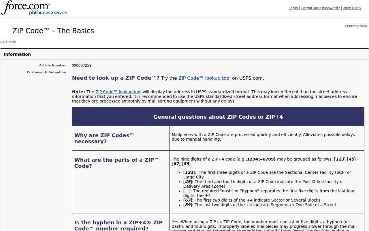
The USPS notice reinforces why a matched mailing code should be treated as delivery evidence, not proof of a person's presence or municipal residence.
Note: Keep the USPS line, parcel location, city field, and record date together when a Jeffersontown address sits near an edge.
Verify Jeffersontown ZIP Code
The USPS ZIP Code Lookup provides three different routes. Choose the route that matches the known fact. An address search standardizes one delivery line. A city-and-state search returns postal associations. A ZIP search returns the city or post-office names attached to that five-digit code.
| Lookup mode | Fields | What it answers |
|---|---|---|
| By Address | Street, city, state; optional company, unit, ZIP | Standard form and delivery ZIP |
| By City and State | City and state | ZIP and post-office associations |
| Cities by ZIP | Five-digit ZIP | Postal city names tied to the code |
USPS warns that a successful address result does not confirm that a person or firm is at the location. It confirms the mailing format. That distinction matters whenever a name from another source is joined to a Jeffersontown ZIP code.
Find Jeffersontown Residents by ZIP
There is no free official roster of all residents in one Jeffersontown postal area. The workable method narrows geography, then consults the source suited to the question. Some portals accept a ZIP. Others require an address, parcel number, personal name, or formal data order.
- Validate the delivery address with USPS. Save the exact street line, city label, and five-digit code.
- Open the LOJIC Online map. Search the address, display the ZIP layer, and compare the parcel with the incorporated boundary.
- Use the free Jefferson County PVA search with the address or parcel ID. The public form does not offer ZIP as a stand-alone search.
- For voter data, distinguish the individual Kentucky lookup from a regulated SBE-84 file order. The individual form has no ZIP or county field.
- Once a ZIP is narrowed to an address range, use the Jeffersontown by-street directory for parcel and deed work.
Deed searches also lack a ZIP field. They use party name, date, instrument type, book and page, control number, or reference number. Start from a mapped parcel, not from the ZIP alone. The result stays tied to a legal record rather than a broad postal assumption.
Map Jeffersontown ZIP Polygons
LOJIC is the bridge between a postal code and a parcel. Its regional map can place USPS ZIP polygons beside roads, parcels, neighborhoods, and municipal boundaries. The address geocoder accepts Street, ZIP, City, State, or a single-line address. Map layers can then answer whether one code touches several parts of the metro area.
This is an important geography quirk. LOJIC says several ZIPs have multiple noncontiguous polygons because codes can cross county boundaries. A colored ZIP shape is not the same thing as one connected neighborhood. Nor is it a legal survey. Save the parcel ID and open its report before attaching an owner name or jurisdiction to the point.
A county-border voter issue in August 2026 shows why these layers need separate checks. The Jefferson County Clerk's border notice concerned 211 voters at 137 addresses, mainly around Willow Creek and the Jefferson-Oldham line. The question involved a GIS-based reassignment. It did not establish a Jeffersontown ZIP change, but it gives a concrete local example of address geometry affecting an official roll. A ZIP polygon, county line, precinct assignment, and voter record can describe the same point in different ways.
When a mapped address lies close to an edge, save a dated view of each relevant layer. Record the USPS code, LOJIC parcel, county, incorporated city, precinct, and the custodian's current result. If two sources disagree, ask the office responsible for the record being used. The post office resolves delivery data, election officials resolve registration assignments, and county or city mapping staff resolve their own boundary layers. One office's answer should not be extended to every other system.
When the web map fails, use its address search with a shorter standardized string, try the parcel ID from PVA, or ask staff at a PVA or LFPL terminal. A historic question can move to Metro Archives, city directories, newspapers, or USPS postal-history material.
Jeffersontown ZIP Search Limits
Official systems treat ZIP data in different ways. That asymmetry prevents a one-click ZIP code directory from being complete. LOJIC can map a ZIP and geocode an address. PVA starts with address or parcel ID. The deed index works from names and document references. The Kentucky individual voter lookup needs legal first name, last name, and date of birth, with the last four Social Security digits optional.
| Source | ZIP function | Important limit |
|---|---|---|
| USPS | Address, city/state, or ZIP lookup | Mailing result is not occupant proof |
| LOJIC | ZIP polygons and geocoder field | Polygon may be noncontiguous |
| PVA | ZIP appears with an address result | No free stand-alone ZIP tab located |
| Voter records | ZIP in regulated file products | SBE-84 purpose, format, and fee rules apply |
| Census | ZCTA statistics | Not a resident or delivery lookup |
In-person channels fill gaps. The post office can address mail questions. PVA and LFPL terminals can support deeper property work. The city or county clerk can confirm a specific held record. Election officials control voter-file requests.
Jeffersontown Limits and ZIP Boundaries
A Jeffersontown ZIP code can disagree with the city line for several reasons. The postal city may differ from the incorporated city. A polygon can cross a city or county edge. One road can pass through more than one jurisdiction. A parcel may also have a situs address that differs from the owner's mailing line.
- ZIP Code
- A five-digit postal routing code. It is not a city boundary.
- ZIP+4
- The basic code plus four digits that narrow a delivery segment.
- ZCTA
- A Census statistical shape that approximates a ZIP area.
- Carrier route
- A mail-delivery path within a postal area, not a neighborhood border.
- Unique ZIP
- A code assigned to a high-volume recipient rather than a general district.
Jeffersontown research should preserve each source's own label. USPS supplies the mail line. LOJIC supplies the mapped point and parcel. PVA supplies the property address. City sources establish municipal jurisdiction. None should be silently substituted for another.
The wider Jefferson County address grid adds another layer. Official numbering uses quadrant baselines and 100-number blocks, while city history says Main and Market later became Watterson Trail and Taylorsville Road. An old directory may therefore carry a road name that does not match today's USPS line. No official Jeffersontown renumbering date was located, so the safe bridge is the deed's legal description, the LOJIC parcel, the official Street Index File, and a dated directory entry.
This also limits historical ZIP searches. A present code should not be added to an old household merely because the current parcel has it. Search the period's street form first, then use postal-history sources, city directories, newspaper mastheads, Sanborn material, or archival maps for dated context. Keep the historical address and modern standardized line as two fields. That preserves the evidence without suggesting that postal geography stayed fixed.
Boundary check. A ZIP match narrows a search, but only a parcel and municipal map can place an address within Jeffersontown.
Jeffersontown Post Office Record
The official USPS station record provides the clearest in-person contact attached to the Jeffersontown name.
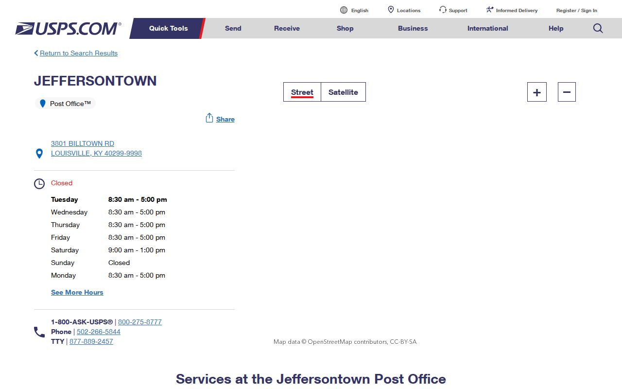
The captured listing connects the 40299 code with a named station while its Louisville mailing line demonstrates why postal and incorporated place names must remain distinct.
For older postal evidence, search city directories, newspaper mastheads, Metro Archives, and the USPS post-office-by-ZIP history tool. No official realignment year was found for the Jeffersontown codes, so a current ZIP should not be projected backward onto an old address without dated support.